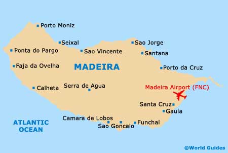
Madeira Airport (FNC)
Orientation and Maps
(Madeira, Portugal)
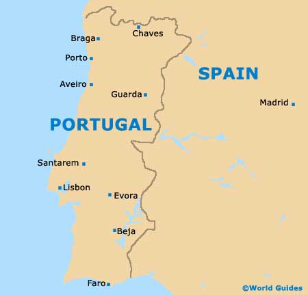
The island of Madeira lies to the south-west of mainland Portugal and is the largest island in a small Portuguese archipelago. Other nearby islands include Desertas, Porto Santo and Savage. Covering more than 740 square kilometres / 285 square miles, Madeira is approximately 57 km / 30 miles in length, and around 22 km / 13 miles wide.
Located next to Santa Cruz, Madeira Airport (FNC) is just a short distance from Funchal and stands on the coastline. In total, the coast of Madeira stretches for more than 130 km / 80 miles and covers a diverse mixture of scenery, including many high cliffs and ravines.
Madeira Airport (FNC) Maps: Important City Districts
On the southern side of the island you will find the remains of a spreading laurel forest that once covered the whole of Madeira. Further forested areas stand close to the northern shore and around the valleys, being listed by UNESCO as a World Heritage Site. Many hiking trails are located around the island, offering countless spectacular and elevated views along the way.
The capital of Madeira, Funchal is a busy and modern city, with a population of around 140,000 inhabitants. Founded at the beginning of the 15th century, Funchal offers a range of historic attractions, being passed by the busy superhighway, which connects nearby Santa Cruz and Madeira Airport. Funchal's harbour area is sheltered by a natural amphitheatre of hills, which are full of rising houses and local communities.
Portugal Map
Madeira Map